

Yesterday was an amazing run in beautiful country with a great group of friends. We started in the Military reserve and ran to the Ridge road via Crestline, Sidewinder, Trail 4, Trail 6, back to 4, the up 8th to the ridge. After that it was up and over Deer Point, Shafer Butte, Mores Mtn, and another couple miles to the turnaround. The turnaround was at 27 miles and we cut a bunch off on the way back.
I dropped my pack at about mile 17 at vehicle that was a roving aid station. Shortly after that snowdrifts, covered the road so the vehicle couldn't get by. This left me 10 miles to the turnaround with half a bottle of water and a couple of snacks. Luckily I grabbed all of my electrolyte tablets and camera out of my pack.

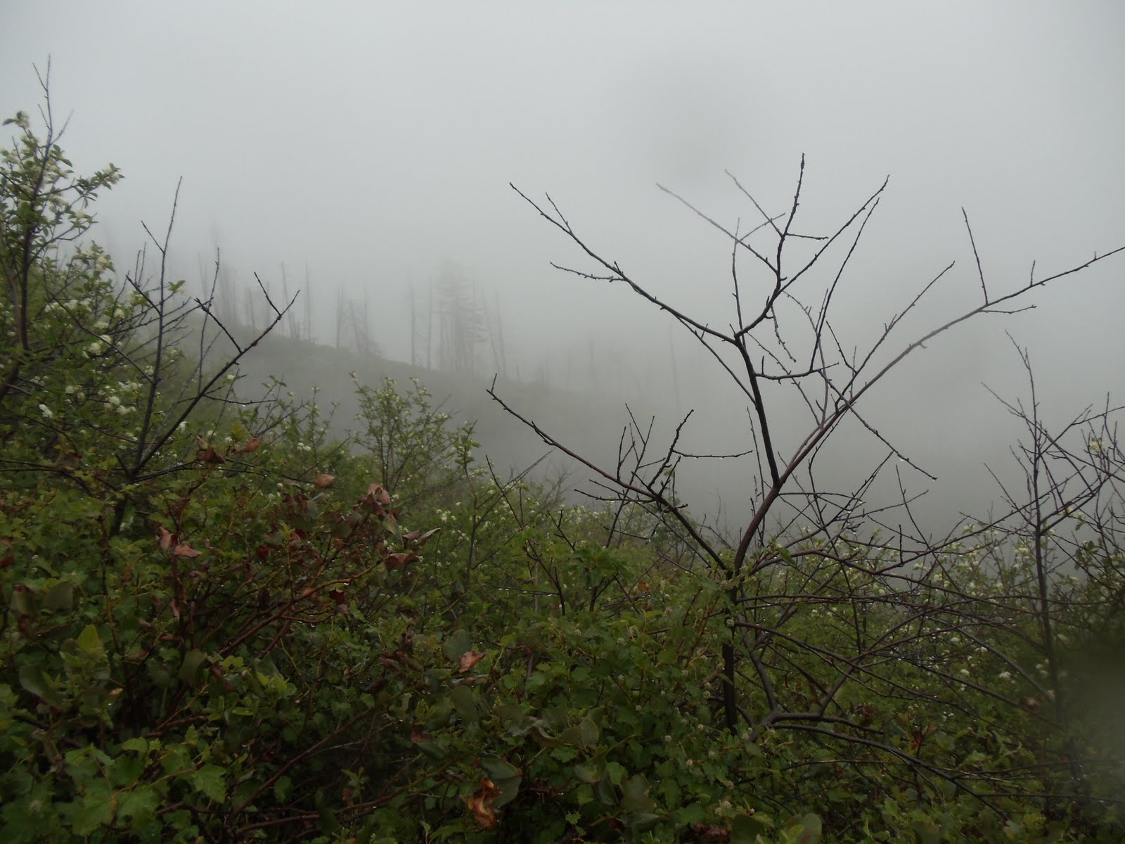
Shortly after contemplating my fate I caught up to Randy and Sparkle who were ahead of me. They were kind enough to share some gel, powerbar, M&Ms, and water. We ran together for a bit and then I took off ahead. I was doing ok except that now that I didn't have a pack I also didn't have a map, so I was just wingin it! Once I hit the top of Shafer Butte I took the switch backs down the other side and made it to the Shafer Butte campground. I had no idea where I should be going at this point so I waited for Randy and Sparkle to catch up. They knew where we were going so we ran together around the back of Mores Mtn. It was snow covered on the back. We got some good video and photos!


On the way back I unintentionally shorted Mores Mtn. There are a number of cross connecting trails up there and with all the snow I ended up on the last cross connector. Oh well. Then when I went to climb Shafer the switchbacks seemed way too long so I climbed straight up, near the Superior chairlift. Paul and Steve took the snow route down on the first half (which would have been smart for me) so I figured I would try it on the way back up. It felt slow but I bet it was faster than the switchbacks!
At about 1pm, just as Leon (RD) told us, clouds rain and wind came in and it got really cold, really fast. I packed pants and a long sleeve but they were back where I left them at mile 17 or so. I met Leon just below the gate to the Deer Point chairlift and he asked me if I was warm enough. I was cold but getting close to where I left my pack although not 100% certain the vehicle or my pack would be there. He offered me a jacket so I took it and headed down the hill. A mile or two later I caught Randy, Sparkle, and Gene (another guy who joined in for a portion). They had skipped Mores Mtn on the way back so they got ahead of me. The aid station vehicle had dropped a box of water, snacks, and my pack which I was thankful to see.


All in all it was a wonderful day. The weather was a little wierd but never too bad. I felt good at the end too. I took some advice of Dennis and others when I comes to fueling a pacing which helped my day a lot. I tried to keep the pace quick but not so fast I was spending too much energy. Also, I rationed out my food and had tried to stick to about about 300 calories an hour. I set my watch to go off every 30 minutes to remind me to have 150 calories and on the hours I took my electrolyte tablets. In Pocatello I think I took them when I felt like I needed them. I went too long at one point in Pocatello and couldn't get it together after that.
The race starts and ends at the Frank Hanson TREE OF DOOM in Fort Boise. I have no idea what the story is behind the name but they told me I had to kiss it when I finished! Not only did I kiss it, I gave it a big hug too, I was happy to be done!


No comments:
Post a Comment